topic: use cases
The emerging UAV (Unmanned Aerial Vehicle) or Drone technology is causing both excitement and anxiety regarding the potential uses. Government, industry and non-governmental organizations all agree that is a wave of new capability and threats that must be jointly understood and coordinated.
This video provides and overview of UAV or Drone Use Cases that provide you with a small sample of how drones are being used in the public and private sectors for normal day-to-day operations, research, law enforcement and disaster response to name a few. There are over 50 uses cases today and the number is still growing.
This is part of a series of drone educational webinars being collected and/or produced for public/private sector organizations.
Click the link here; https://youtu.be/M6RXSEVx3zc
Or just click on the VIDEO PLAY button below:
This above video references other online videos for further understanding. These "referenced" video can be separately on the links below.
referenced use case videos
Slide 25 video
URL: https://youtu.be/na5cxDJ0hc4
Published on Mar 23, 2015
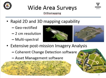
Drone Aerial Photography, 3D Aerial Mapping and Point Cloud Analysis. We utilize drones (UAV's sUAS's) and aerial photogrammetry techniques to develop precise digital surface models and point clouds for industrial asset management. - skyrisimaging.com
URL: https://youtu.be/na5cxDJ0hc4
Published on Mar 23, 2015
Drone Aerial Photography, 3D Aerial Mapping and Point Cloud Analysis. We utilize drones (UAV's sUAS's) and aerial photogrammetry techniques to develop precise digital surface models and point clouds for industrial asset management. - skyrisimaging.com
Slide 28 video
URL: https://youtu.be/ZwTqUtSJqqs
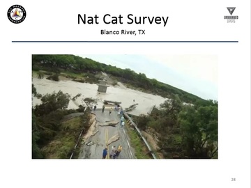
Published on May 24, 2015This bridge over the Blanco River failed on 5-23-2015 after the river rose after more than 12 inches of rain in a very short period of time. This crossing is on Fischer Store Rd, just north of Canyon Lake, TX and West of Wimberley, TX. Footage was from GoPro camera on a Blade 350QX Quadcopter.
URL: https://youtu.be/ZwTqUtSJqqs
Published on May 24, 2015This bridge over the Blanco River failed on 5-23-2015 after the river rose after more than 12 inches of rain in a very short period of time. This crossing is on Fischer Store Rd, just north of Canyon Lake, TX and West of Wimberley, TX. Footage was from GoPro camera on a Blade 350QX Quadcopter.
Slide 32 video
URL: https://youtu.be/fLE2nA-0TBU
Uploaded on Apr 18, 2011
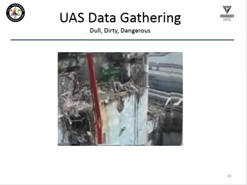
Two robots sent into the reactor buildings at the Fukushima nuclear plant have found massive amounts of radiation, barring any workers from entering. The plant's operator also announced a new 9 month plan to stabilize the situation, proposing to cover the reactors with a Chernobyl-like sarcophagus. The situation at the nuclear complex remains critical, with radiation leaks and difficult access hampering progress.
URL: https://youtu.be/fLE2nA-0TBU
Uploaded on Apr 18, 2011
Two robots sent into the reactor buildings at the Fukushima nuclear plant have found massive amounts of radiation, barring any workers from entering. The plant's operator also announced a new 9 month plan to stabilize the situation, proposing to cover the reactors with a Chernobyl-like sarcophagus. The situation at the nuclear complex remains critical, with radiation leaks and difficult access hampering progress.