Topic: Drone Technology Basics
The emerging UAV (Unmanned Aerial Vehicle) or Drone technology is causing both excitement and anxiety regarding the potential uses. Government, industry and non-governmental organizations all agree that is a wave of new capability and threats that must be jointly understood and coordinated.
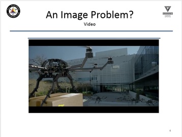
This video provides and overview of UAV or Drone Technology Basics, and provides a basic overview of the drone technologies and capabilities as of Jan 2016. It provides a great basic perspective on the technology for novices.
This video references other online videos for further understanding. These "referenced" video can be separately on the links below.
This is part of a series of drone educational webinars being collected and/or produced for public/private sector organizations.
Click the link here; https://youtu.be/ALQAkT9C0Ws
Or just click on the VIDEO PLAY button below:
watch the "referenced" videos below
Below are some educational videos taken from public source.
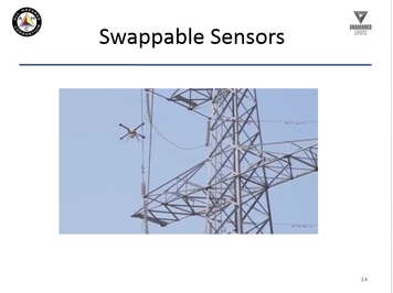
Slide 14 video
URL: https://youtu.be/a2DtzI-p5VA
Published on Nov 25, 2014
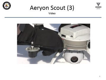
Aeryon's UAS can be deployed in minutes and operate safely in confined environments that are inaccessible to manned aircraft and fixed-wing UAS. Automated features and fly-safe controls also reduce reliance on operator skill and minimize risk. This VTOL's UAS platform can hover at extended range while providing up-close, detailed video and photos, as well as consistent data collection.
URL: https://youtu.be/a2DtzI-p5VA
Published on Nov 25, 2014
Aeryon's UAS can be deployed in minutes and operate safely in confined environments that are inaccessible to manned aircraft and fixed-wing UAS. Automated features and fly-safe controls also reduce reliance on operator skill and minimize risk. This VTOL's UAS platform can hover at extended range while providing up-close, detailed video and photos, as well as consistent data collection.
Slide 15 video
URL: https://youtu.be/BhHro_rcgHoinsert
Published on Jun 2, 2015
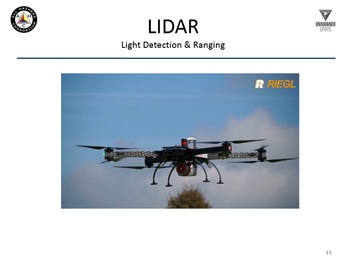
This video is an overview of the Phoenix Aerial AL3-16 LiDAR Mapping system. The AL3-16 can be mounted on any UAV that can lift 2.5kgs. In this video, a DJI S1000 is used and for the demonstration, we flew over an over an open pit. You can see how quickly we generate a dense pointcloud. You'll also see how LiDAR can pick up points underneath vegetation vs Photogrammetry will only map tree canopy.
URL: https://youtu.be/BhHro_rcgHoinsert
Published on Jun 2, 2015
This video is an overview of the Phoenix Aerial AL3-16 LiDAR Mapping system. The AL3-16 can be mounted on any UAV that can lift 2.5kgs. In this video, a DJI S1000 is used and for the demonstration, we flew over an over an open pit. You can see how quickly we generate a dense pointcloud. You'll also see how LiDAR can pick up points underneath vegetation vs Photogrammetry will only map tree canopy.