A New Solution for Decision Makers and Transportation Drivers, Planners and Logistic Professionals Who Need Reliable, Actionable Information
|
|
|
|
|
|
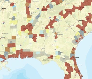
Live Threat Information (e.g. COVID-19 Hotzones) Along the US Highway Routes
|
|
The Fleet Movement App At-a Glance
- Developers: Being developed by private sector members of the AHC’s SISE Working Group
- Use Case: Provide transportation drivers, planners, and logistics people with the most reliable data sources during a disaster to plot routes using major US interstate highways, shows the threats along the route and the resources along the route to support power/utility restoration, supplier deliveries, and logistics fleets as they move across the US
- Operational Impact: Access to real-time sources of reliable, actionable data provides the most reliable situational awareness and allows SISE members to synchronize their decision-making across sectors and with participating states.
- Data Sources: State/local DOTs, EOCs, open-source, private source. All data ranked as ORL1 or ORL2 for confidence & reliability with the ORL (Operational Readiness Level) Data Confidence Standard.
- Sensitivity of Data: Contains both public sources and private sources data. Not available for public use. FOUO only.
- Unique:
- Aggregates vetted and ORL (Operational Readiness Level) ranked data into a single place
- Provides access to real-time state DOT/511 data nationwide in a single data layer (the most reliable transportation data source during a disaster)
- Combines threats and resources data along the route for fleets to avoid (COVID hot zones) and use as needed (lodging food, fuel, etc..)
- Over 2.0+ million data points and growing
- Navigation: “Zoom in” to see other data layers:
- COVID-19 case hot zones by county, live feeds
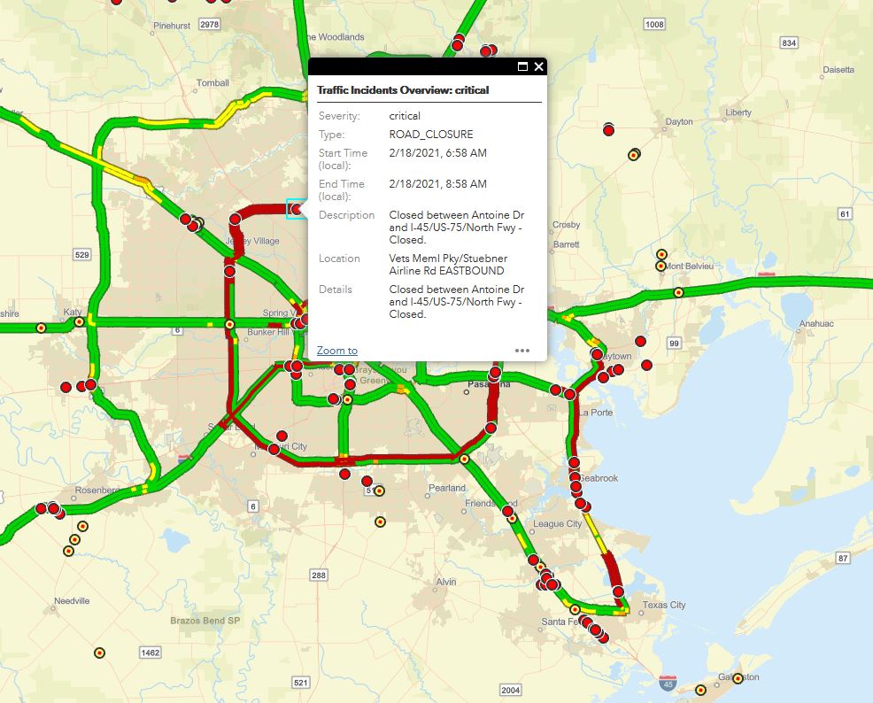
- State/local road closures. live feeds
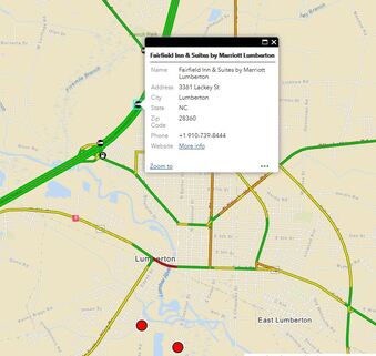
- Possible resources needed along the routes (locations for food, lodging, fuel, hospitals, truck maintenance shops, rest stops, commercial fueling, PPE suppliers, generator suppliers, pharmacies, big box stores, weigh stations, Flying J, Pilot, Travel Centers of America, SpeedWay, RaceTrak, and more....etc..